Meteory : diagnosis& environmental monitoring
Market leader of public sectorMeteory help local communities to monitor their territory by gathering all the environmental data in one and only intuitive platform, facilitating not only the diagnosis, but also the monitoring of their territory.
Our Goal
Make environmental dataaccessible
Nowadays, the data enabling local communities to take enlightened decisions about their territorial environmental policy are already available. Unfortunatly, they are scatered on different websites, too few contextualised, and very often presented as huge spreadsheets not very readable. To solve this accessibility problem, Meteory offer one unique platform, enabling people to easily consult their territory environmental data. The goal is to give a global and precise picture of the current situation of a territory, but also of its evolution
As Head of the Ecological Transitions Department, the Meteory platform is an excellent decision-support tool. The integration of various datasets into a single tool enables better data cross-referencing. Additionally, direct access to maps and charts saves me a significant amount of time.


Pricing
Tailor-made prices
All your territory environmental data, in one single price.
To best meet the needs of our clients, we apply a pricing structure based on the requested datasets and the total area of the territory to be analyzed. If you are interested, please don't hesitate to contact us by email at pierre.blanchet@meteory.eu, or directly at 06.49.36.24.91 for any questions or a quote request. We will get back to you within 24 hours.
Carbon Sequestration Diagnosis
Measure the carbon sequestrationof your territory
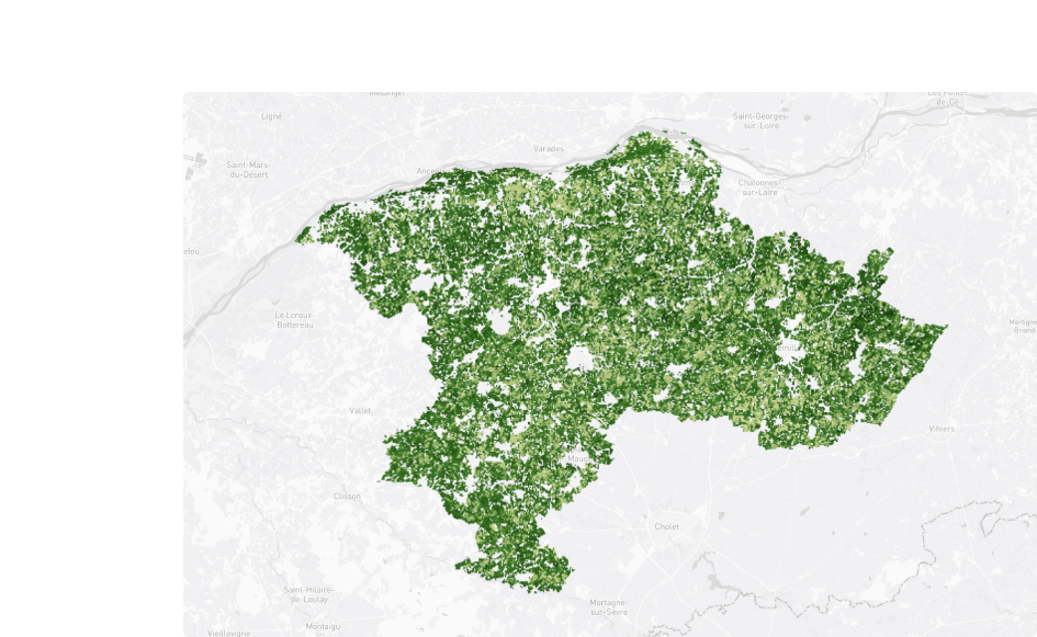
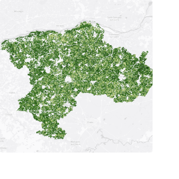
Carbon Sequestration
-2.1 %Of carbon sequestrated into the soils of France in 2023 compared to 2022.
Conduct a review of the fluxes and the quantity of CO2 stored in the soils and forests of your territory. Identify the areas that stores the most, as well as that that stores the less. Compare, analyse, understand and find and find the most sustainable way to improve the overall absorption potential of your territory.
Landcover Diagnosis
Control the soil artificialisationover time
Establish a report on the soil artificialization of your territory over the past years and adapt your environmental policy accordingly. Support your local urban planning with reliable data, and measure their impact over time.
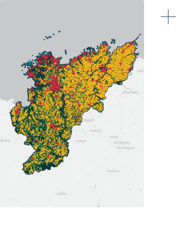
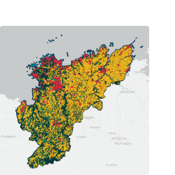
Urbanisation
+5.6 %Built-up areas in France between 2020 and 2023.
Vulnerability assessment to the impacts of climate change
Analyze the vulnerability of your territoryto climate change
Study the current and future climate risks to which your territory is exposed. Measure their probability, identify the risk areas, and adapt your urban plans accordingly.
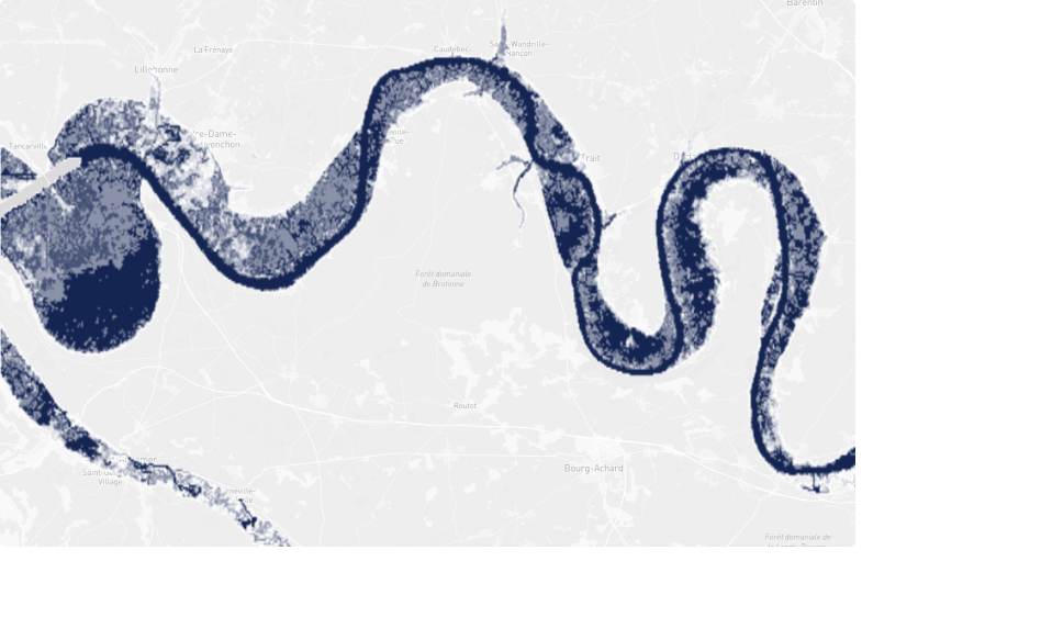
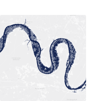
Flooding Risks
+6.8 %Flooding risk increase since 2021.